Yes, this is a bit late to post a “Best of 2022” blog, but I’ve been busy. I had the idea of posting 10 favorite photos of the year, but then had the better idea of limiting these images to atmospheric phenomena and clouds. Cloud formations, rainfall, rainbows, and other unusual scenes in the skies above are some of my favorite subjects to photograph and blather on about. And it seemed appropriate to post images of clouds since this year has started out-at least in California-as a very wet one! Let’s hope the cold rain and snow continue without too much collateral damage. These photos span the year from New Year’s Day 2022 to New Year’s Eve of 2023.
I hope you enjoy them. Have a happy and healthy 2023.
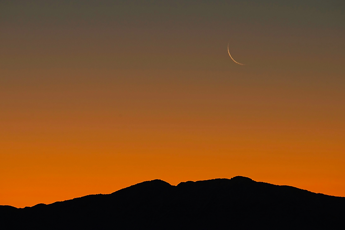
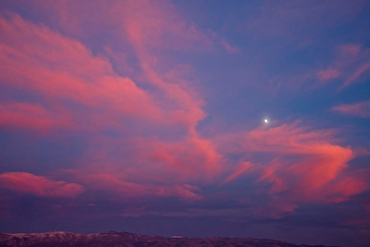
Waning moon rises over the Inyo Mountains, just ahead of the New Year’s Day sun of 2022 (1/1/2022).
Living in a house on the lower slopes of the Eastern Sierra is a cloudspotter’s dream, and I am grateful for that every day. Lenticular clouds, known locally as “Sierra Wave” clouds, form on the lee side of mountains. They are manifestations of a standing wave that forms as air rushes eastward over the Sierra ahead of some cold fronts. The air rises over the west slope then falls east of the mountains, and rises and falls again with peaks and troughs. These altocumulus lenticularis clouds form as water vapor condenses at the front edge of the cloud, which then sinks and evaporates at the clouds east edge-similar to the way a standing wave forms downstream of a river rock. The thinner high cirrus clouds on the right could have originally formed from contrails by jets on their way to or from southern California. Such “man-made” high clouds are called cirrus homogenitus.
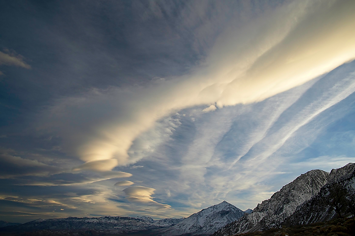
Lenticular clouds with cirrus, above Round Valley, Eastern Sierra, CA (12/9/2022).
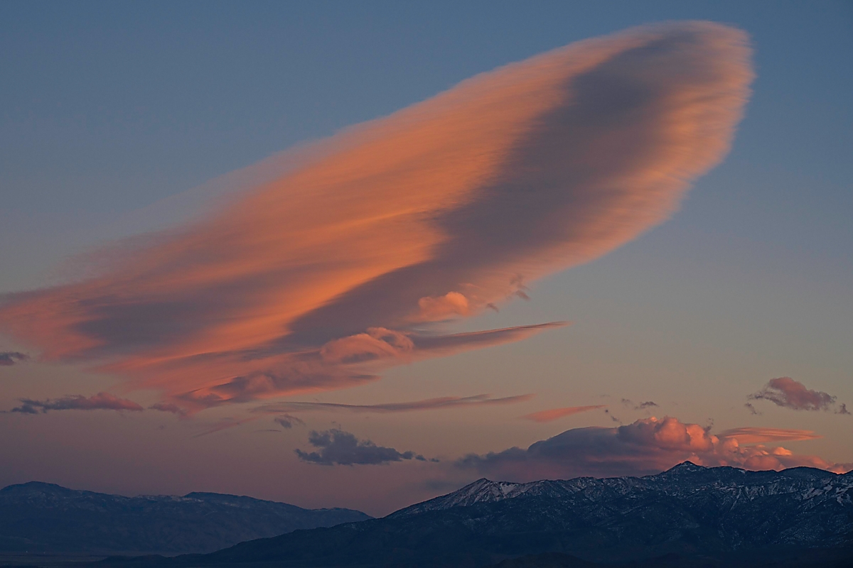
A (sperm) whale of a lenticular cloud formation above Owens Valley, CA (2/21/2022).
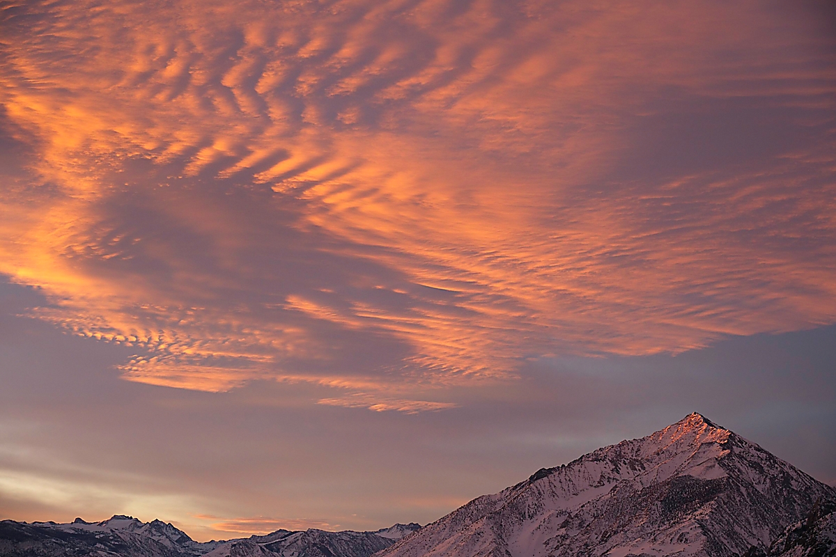
A close relative of the lenticular cloud species is the eyebrow cloud, known by some as the supercilium cloud, seen here above Mount Tom. Both are orographic clouds that form above or just downwind of mountains. Supercilium is Latin for “eyebrow” which they resemble. This name is not (yet) recognized by the World Meteorological Organization so you won’t find it in the International Cloud Atlas. The Cloud Appreciation Society (of which I am a member in good standing), however, hopes to add this supplementary cloud to the Cloud Atlas, first published in 1896. You can read the open access short paper in the Royal Meteorological Society’s recent Weather journal here. The Cloud Atlas was last updated in 2017 with 12 revisions (homogenitus was one of five new special cloud types named then). Supercilium clouds tumble and break in the turbulent air above mountains and form as quickly as they vanish. I have always been captivated by these rare and rapidly changing clouds, but frustrated at not being able to identify a cloud that “still evades a precise description when using all available terms…” So when eyebrow clouds become part our common vernacular, remember you heard about them here first.
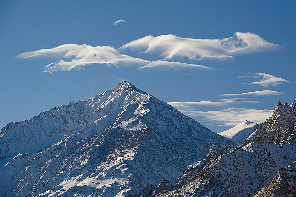
Lenticular and supercilium cloud formations, preceding a big winter storm (12/9/2022).
A 22-degree halo is not especially rare, but nonetheless always a nice surprise, and more so when seen above a nice foreground element. The halo is caused by refraction of the sunlight at 22 degrees through hexagonal ice crystals that make up the cirrus clouds seen here above the White Mountains. The combined sparkles produce a halo that is 22 degrees from the sun (or moon).
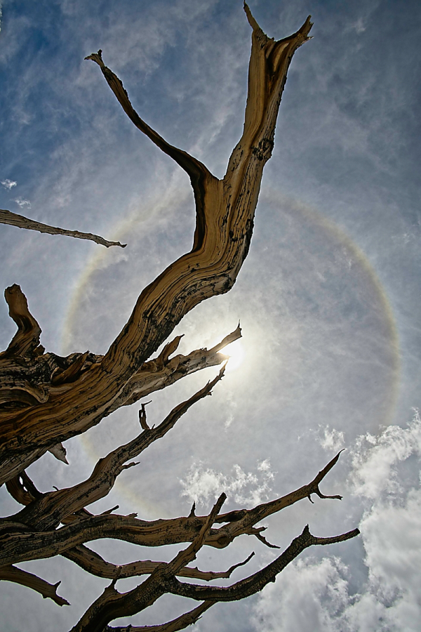
22-degree halo with Great Basin bristlecone snag, Patriarch Grove of the Ancient Bristlecone Pine Forest, White Mountains, CA (8/11/2022).
The best views of the Milky Way in the northern hemisphere occur in the summer, but only away from bright city lights. The dark sky of the Grand Canyon is perfect.
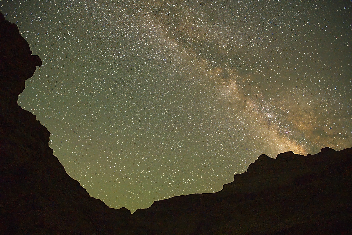
Milky Way from 110 Mile Camp along Colorado River, Grand Canyon National Park, AZ (5/11/2022).
And who doesn’t appreciate a beautiful sunrise? High clouds such as these reflect the red-orange end of the visible spectrum because their longer wavelengths scatter less than the blue when passing through the atmosphere at a low angle.
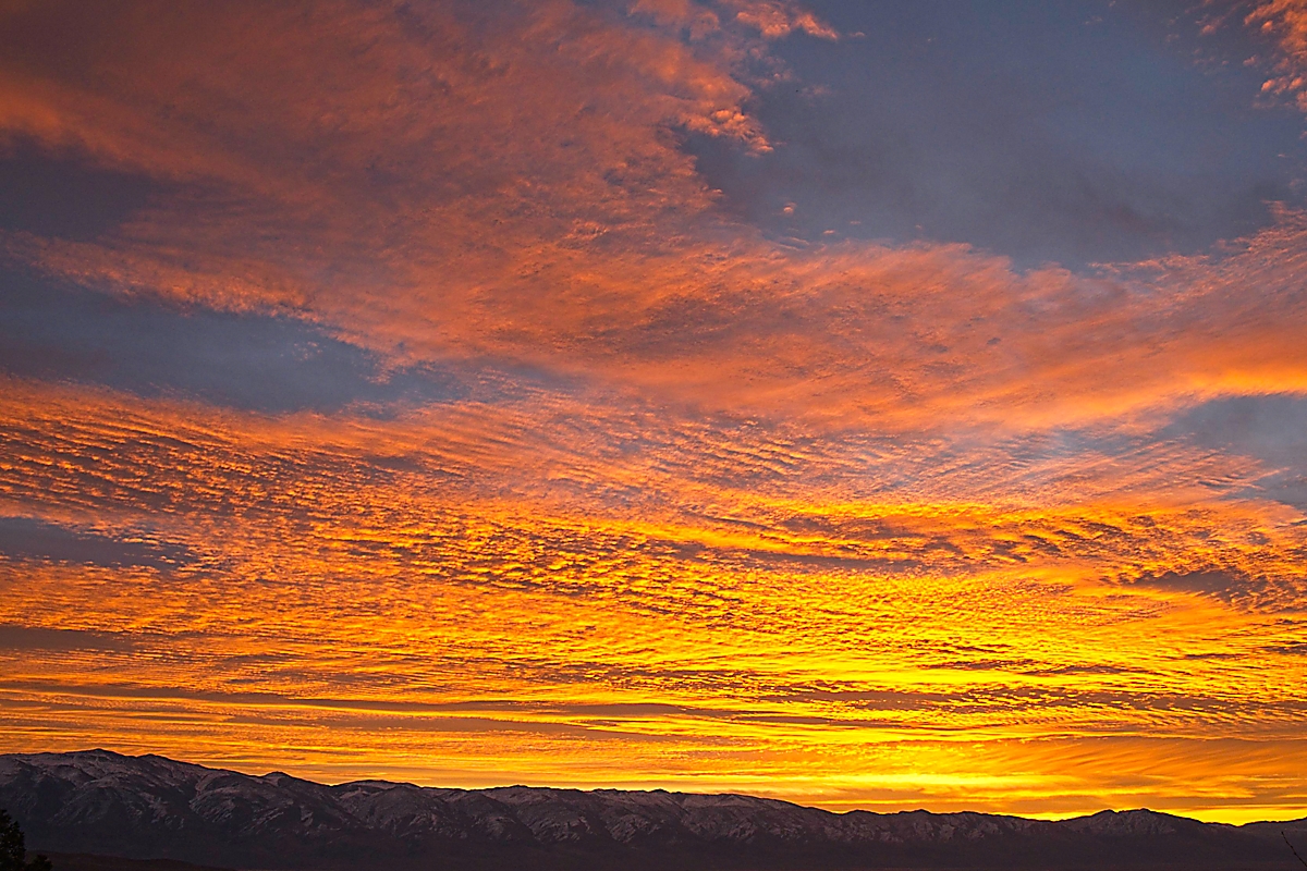
Sunrise above the White Mountains with a layer of altostratus and other clouds, CA (12/26/2022).
This photo below was made a few minutes after the one above as the sun rose above the mountains to light the peak of Mount Tom and the orange color began to fade. The parallel lines of cloud are known as undulatus and form perpendicular to the wind, much like ocean waves and sand ripples.
Sunrise with altostratus undulatus and other clouds above Mount Tom, Eastern Sierra, CA (12/26/2022).
Although rainbows are beautiful, they are not especially rare. But when a rainbow is paired with anti-crepuscular rays, that is something special. The more familiar crepuscular rays emanate from sunlight behind clouds (or trees) that lights dust, fog droplets, or other tiny atmospheric particles. Anti-crepuscular rays seem to emanate from opposite the sun, which would be in the lower right of the frame here if the rays extended further (or at the center of the rainbow if the sun was high enough to form a complete rainbow). These less commonly seen rays are caused by cloud shadows cast from behind.
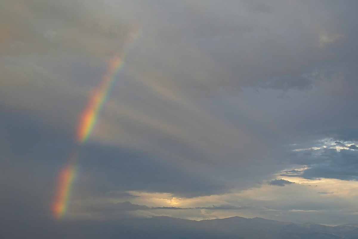
Partial rainbow wheel above northern Owens Valley, with White Mountains in background, CA (8/1/2022).
This final image shows the leading edge of the New Year’s Eve atmospheric river that brought record rainfall and flooding to much of northern California. The rain is just beginning to fall over Bishop as the rising sun’s light gets filtered through nimbostratus clouds.
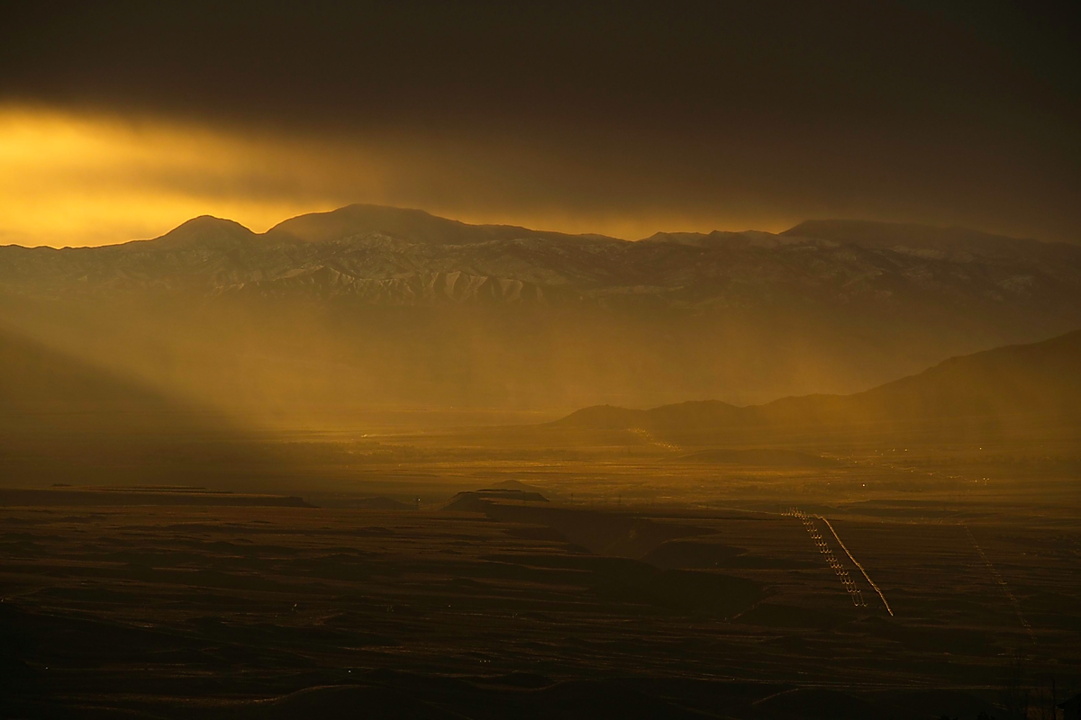
Rain coming from the west while the sun rises in the southeast over the Inyo Mountains, CA (12/31/2022).